 The
Seattle Beginning
The
Seattle Beginning 
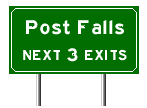
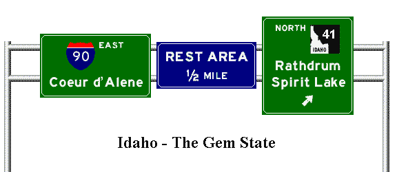
This is my I-90 page covering the evolution of this important Northwest highway. I cover the highway in sections from Seattle to the Idaho - Montana border. The links take you to pictures; all pictures on the internal links are mine. These pictures are quite large, so they may take a while to load with slower connections. They will appear in a separate browser window. I have also provided several external links to relevant information on other websites. The .gif images you see here represent some of the signs you will see when traveling I-90 in Washington and Idaho.
Interstate 90 paper A paper I wrote for a geography class. This is a must read if you have the time.
The
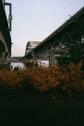
Seattle Beginning The I-90 / I-5 interchange in the distance was the location of Seattle's infamous "ramps to nowhere." These were finished in 1990, save for a couple of ramps to the cancelled R.H. Thomson Expressway which were demolished. (There are still ghost ramps for the R.H. Thomson near Husky Stadium on S.R. 520.)
Prior to 1940 US 10 left town via Airport Way south to Empire Way (now Martin Luther King Jr. Way). Then it followed Empire Way to Renton. From there it followed Sunset Way to Issaquah. In 1940 the Mercer Island Floating Bridge opened, and US 10 now exited Seattle eastward via Dearborn Street. The old route through Renton became Alt. US 10 for a time. Both routes were part of Primary State Highway 2.
 The
Mt.
Baker tunnel has four auto tubes: the two original tubes which carry
the eastbound traffic, the westbound tunnel, and the express lanes tunnel
which begins between the eastbound and westbound tunnels on the west and
emerges from underneath the westbound tunnel on the east.
The
Mt.
Baker tunnel has four auto tubes: the two original tubes which carry
the eastbound traffic, the westbound tunnel, and the express lanes tunnel
which begins between the eastbound and westbound tunnels on the west and
emerges from underneath the westbound tunnel on the east.
The Mercer Island Floating Bridge is actually two bridges: The northern Homer Hadley bridge which carries three westbound and the two reversible express lanes, and the southern Lacey V. Murrow bridge carries three lanes of eastbound traffic. The northern bridge was completed in 1989, the southern bridge in 1993. The original floating bridge sank in a 1990 windstorm while it was closed for renovation. The original bridge approach spans were incorporated into the replacement bridge. The original Mercer Island Floating Bridge had a drawspan nicknamed "The Bulge", which coupled with the reversible lane system instituted in the late 1950's, caused numerous fatal accidents. The drawspan pontoons were replaced in the early 1980's with stationary ones.
The initial design of I-90 called for a much larger freeway. The design was challenged in the courts, and the present award winning configuration was the result.
Leaving Mercer Island I 90 crosses the East Channel bridge which was built in two stages between the early 1980's and the early 1990's. The previous bridge was demolished in the early 1980's.
Pre-1940 US 10 / PSH 2 / Sunset Highway entered Issaquah from the south via Newport Way and Sunset Way. Post 1940 US 10 / PSH 2 went through Issaquah on today's Gilman Boulevard. I 90 was built through my grandparents' property in the late 1960's. There used to be a large railroad trestle over the highway at the east end of town. This was removed in the early 1970's to make room for the freeway.
The speed limit changes to 70 MPH for cars, 60 for trucks just east of Issaquah.
US 10 / PSH 2 / Sunset Highway used to veer north at the town of Preston and passed through Fall City and Snoqualmie on the way to North Bend. Old bridges still survive on that route. A cutoff following the current route of I 90 was built between Preston and North Bend in the 1940's.
Before the bypass was completed in 1978 North Bend was a major bottleneck in Interstate 90. The highway entered town from the west from Exit 31, went through a couple of stoplights, and departed the east end of town on a one-way couplet which joined the present ROW west of Edgewick Road (Exit 34). Traffic would back up for miles on holiday weekends. I can remember as a child returning with my parents from a vacation east of the mountains and having to sit in the backup entering North Bend. Final routing of the freeway here was held up for years by lawsuits filed by area residents.
The eastbound entrance ramp at Edgewick Road has a gate. Occasionally Snoqualmie Pass is closed due to the weather or for avalanche control. This is where the highway is closed. There is also a chain-up area for those times when snow falls in the lowlands.
You are now leaving the "Apple Maggot Quarantine Area".
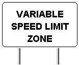 Snoqualmie
Pass has a variable speed limit zone. The speed
limit changes depending on the weather. The regular speed limit is 65 MPH.
Snoqualmie
Pass has a variable speed limit zone. The speed
limit changes depending on the weather. The regular speed limit is 65 MPH.
Bridge on old Sunset Highway This is on the entrance road to Ashael Curtis campground at exit 47. It is the start of the old switchback road up Snoqualmie Pass. leaving the exit you will be following the old westbound lanes of US 10 / I-90 (1950-1981). The road then turns and follows the pre 1930's US 10 / PSH 2 / Sunset Highway alignment up the valley. This road is passable above the campground in the summer and accesses several popular trailheads. There is a preserved section of the original wagon road on this section as well. On a side note this road was used as a detour in the 1960's when a rockslide blocked the freeway above.
Snoqualmie Pass Viaduct Construction began on this in 1972, but was halted by lawsuits from environmental groups. Construction resumed in the late 1970's and was completed in 1981. It carries westbound I-90. It crosses the valley of Denny Creek and an avalanche-prone mountainside. It was designed to allow avalanches to pass underneath. when this stretch was completed the old alignment was closed for a summer and rebuilt for eastbound-only traffic.
After the Milwaukee Road tunneled under Snoqualmie Pass they gave their old right-of-way to the state. This was used to relocate US 10 on the west side of the pass in the 1930's. This section was initially two lanes, but was upgraded with the rest of US 10 between North Bend and Cle Elum to 4 lanes in the early 1950's. A snowshed was built over the climbing lanes in 1950 to channel avalanches over the road while allowing the state to keep the road open during cleanup. This snowshed was removed in in the 1981 reconstruction and replaced with a cannon which is used for periodic avalanche control. For a real-time view of conditions on Snoqualmie Pass go here WSDOT Snoqualmie Pass.
The highway has had several alignments at the summit through the years. The original alignment is today's Yellowstone Trail, a residential street. In the 1930's the route was changed to follow today's SR 906. Part of this alignment was used for the 1950's 4-lane route. I 90 was completed around the summit ski areas in 1970, and widened to 7 lanes, if memory serves, around 1981-82.
I 90 drops to four lanes at Lake Keechelus and remains that way, with the exception of the westbound truck lane at the Easton Hill, until it reaches Spokane. This section around the lake is deteriorating badly. The old concrete was asphalted over a few years ago but this is wearing through. It is also prone to avalanches, although they are less common here than they are west of the summit. There is a snowshed over the westbound lanes which used to be used for two-way traffic during avalanche cleanup operations. There used to be gaps in the jersey barrier at either end of the snowshed which allowed eastbound traffic to cross over, but these were filled in years ago. Plans are afoot for a major realignment of the freeway here, possibly routing the eastbound lanes down the east side of the lake (the freeway runs almost N-S here), but this would be contingent on the results of the EIS and funding. I90_Project (Washington State Department of Transportation)
The speed limit returns to 70 MPH at Easton.
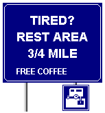 This
sign can be found approaching rest areas on Interstate 90, most notably
just before the Indian John Hill rest area, which is the first rest area
east of Seattle, excluding the old "Travellers Rest" building on SR 906
at Snoqualmie Summit. Yes, it is 88 miles between Seattle and the first
rest area. There were two additional rest areas in the original plan for
I-90. The first, to have been located just east of exit 31 in North Bend,
was never constructed. The only evidence of its proposed location is a
slightly wider shoulder westbound where the entrance and exit ramps would
have been. The second, located just east of Lake Keechelus, was partially
constructed with entrance / exit lanes and parking. It was used for several
years as U.S. Forest Service "Sno-Park Parking" for winter recreation.
The ramps now have jersey barriers across them. This explains why the Indian
John Hill eastbound rest area is so busy. Advice: Drink your beverages
sparingly until you get east of the pass. Highway rest areas are more frequent
between Cle Elum and Coeur d'Alene, Idaho.
This
sign can be found approaching rest areas on Interstate 90, most notably
just before the Indian John Hill rest area, which is the first rest area
east of Seattle, excluding the old "Travellers Rest" building on SR 906
at Snoqualmie Summit. Yes, it is 88 miles between Seattle and the first
rest area. There were two additional rest areas in the original plan for
I-90. The first, to have been located just east of exit 31 in North Bend,
was never constructed. The only evidence of its proposed location is a
slightly wider shoulder westbound where the entrance and exit ramps would
have been. The second, located just east of Lake Keechelus, was partially
constructed with entrance / exit lanes and parking. It was used for several
years as U.S. Forest Service "Sno-Park Parking" for winter recreation.
The ramps now have jersey barriers across them. This explains why the Indian
John Hill eastbound rest area is so busy. Advice: Drink your beverages
sparingly until you get east of the pass. Highway rest areas are more frequent
between Cle Elum and Coeur d'Alene, Idaho.
East of Cle Elum (Teanaway Junction, to be exact) PSH 2 / Sunset Highway turned north over Old Blewett Pass and followed present SR 970, US 97 and US 2 to Spokane. US 10 used this route until World War II. In the early 1940's US 10 was rerouted via US 97 / PSH 3 / Inland Empire Highway between Teanaway Junction and Ellensburg; PSH 7 between Ellensburg and Burke Junction (today's George); PSH 18 between Burke Junction and Ritzville; and US 395 / PSH 11 between Ritzville and Spokane, where it rejoined PSH 2 / Sunset Highway and PSH 3 / Inland Empire Highway. For a few years in the 1940's the old US 10 route was known as Alternate US 10. This designation was dropped when US 2 was commissioned over Stevens Pass in the late 1940's. I 90 was completed in the mid-1960's. The Teanaway Junction to Ellensburg segment of old US 10 remains in the state highway system as SR 10. On my last trip I spotted some old PSH 3 bridge markers but was out of film so I couldn't take a picture.
SR10 sign goof - Oops!! I found this sign on Business 90 (old US 10 / 97 / PSH 3) just west of Ellensburg. It points to the "Dry Creek Connector" section of old US 10 / 97 / PSH 3. The signmaker must have been from Kentucky.
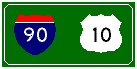
US 97 is multiplexed with I-90 between exit 106 and exit 110.
Milwaukee RR trestle over I 90 east of Ellensburg. Highway engineers fit the freeway between the piers of the trestle, while at the same time bridging a road and a creek. The rail line is abandoned, and is now part of the John Wayne horse trail.
I 90 Ryegrass Westbound on I 90 climbing to Ryegrass Summit. This is a long steep grade that causes vehicles to overheat and sometimes burn. Also I do not recommend taking pictures while driving. Please do not follow my lead.
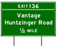
Construction of Wanapum Dam in the early 1960's and the highway's designation as an Interstate necessitated construction of a new Vantage bridge and relocation of the approaches. These were completed in 1962. The old Vantage Bridge was then dismantled and reassembled at Lyons Ferry on SR 261, replacing the cable ferry there.
The next few links take you from this site:
Vantage
ferry east approach 1926 (Washington State Dept. Of Transportation)
Vantage
Bridge 1927 (Washington State Dept. of Transportation)
Vantage
Bridge showing east approach relocation (Washington State Dept. of Transportation)
new
Vantage Bridge in 1962 (Washington State Department of Transportation)
This is how the east end of the new I-90 bridge at Vantage looked before
the reservoir behind Wanapum Dam was filled. This is the interchange with
SR-26, then known as State Secondary highway 7C. At the right edge of this
photo, leaving the curve of the onramp on a tangent, you can see where
SSH 7C previously descended the bluff on a steep grade to the old bridge.
This old grade can be seen from eastbound I-90 as you are crossing the
bridge. I 90 makes a 90-degree turn to climb the bluffs here.
 The
Vantage area today
The
Vantage area today
terraserver
1 Image showing old US 10 / PSH 7 emerging from Schnebly Coulee and
entering the water at top left. The old SSH 7C old bridge approach emerging
from the water on the right.
Pre-1930
highway below the Scenic View It's barely visible just above the water
line.
terraserver3
1930-1962 US 10 / PSH 7 alignment entering the water at the top left, pre-1930
PSH 7 alignment climbing the cliffs in the center of the photo, I 90 on
the right.
terraserver
4 A closer view of the pre-1930 PSH 7 alignment and Interstate 90.
terraserver
5 1930-1962 on the left, US 10 emerges from the river and ascends the
coulee to a junction with I 90 just east of the interchange at the upper
right. The area where US 10 summits the coulee, at the right edge of the
photo near the interchange, was once called "Hilltop." There was an old
gas station next to the clump of trees until a few years ago. This road
is drivable - it's signed as "Old Vantage Highway" and accesses rock climbing
areas and a boat launch. The interchange and the road leading to the north
were built in the early 1980's. This road leads to The Gorge at George
Ampitheatre, a popular outdoor concert venue.
personal pics:
horses The Wild Horses sculpture at the eastbound scenic viewpoint.
I 90 Vantage Bridge A view looking east. Strong crosswinds are present, and windsocks are posted on the bridge and the east approach so drivers can gauge the velocity and direction of the wind. I have seen campers and trailers blown over here.
West approach to old bridge The white line is the old highway centerline. This is now used as a boat launch. The old Vantage townsite is just offshore.
East approach to old bridge Looking downriver, 1930 - 1962 alignment. The end of the road angles into the river and is now used as a boat launch and camp area.
hill and bridge marker I had fun taking this one!! This shows how the highway clung to the cliff and a PSH 7 bridge marker I found. Note the post and cable guardrail, which was common in Washington State circa 1930's - 1950's.
Lyon's Ferry Bridge Here is a
picture of the old Vantage Bridge in its relocated home at Lyons Ferry
on the Snake River.
 George
to Ritzville
George
to Ritzville
US 10 Schrag looking east This is the last section of US 10 in eastern Washington to be bypassed. I 90, which lies to the north, replaced this section in 1972. This section of highway was constructed in the late 1930's and was originally known as Primary State Highway 18. There was no direct highway connection between Neppel (today's Moses Lake) and Ritzville prior to the 1930's.
US 10 Schrag looking west - Note the concrete post and cable guardrail and Mt. St. Helens ash on the shoulders.
Ritzville wye US 10 / PSH 18 junctioned US 395 / PSH 11 just east of this railroad overpass. This view is looking east. Ritzville was bypassed to the south by I 90 in 1959.
Ritzville I noticed this mileage sign on the old alignment of US 10 / 395 PSH 11 entering Ritzville from the south in May 2000. It's a wooden sign, and it most likely predates I 90. Although the main road through town is Business-90, this sign is still unusual on a business route. I have also found one of these on an old alignment of US 395 / PSH 11 south of Connell.
 Ritzville
through Spokane
Ritzville
through SpokaneSprague US 10 / 395 / PSH 11 through the town of Sprague was bypassed by I 90 in 1968. Today this stretch of road is maintained by Lincoln County and is known as the "Sprague Highway."
The speed limit drops to 60 MPH outside of Spokane.
Old US 2 and 10/395 split. In west Spokane, US 2 / 10 / 395 followed Sunset Boulevard, a 4-lane thoroughfare. From the 1930's to the 1960's US 2/10/195/395 (PSH 2 / 3) left downtown on 2nd and 3rd Avenues to a wye intersection with the old Inland Empire Highway, where US 195 (PSH 3) went south, and US 2/10/395 continued west on Sunset and up Sunset Hill to this junction. (Prior to the 1930's US 2 / 10 followed Riverside Avenue through High Bridge Park.) Here, US 395 (PSH 11) made a left exit off of Sunset and followed Geiger Blvd. US 2 (PSH 2) continued west on the Sunset Highway. Prior to the early 1940's US 10 also continued west on Sunset. In the early 1940's, a few years after the completion of PSH 18 between Burke Junction and Ritzville, US 10 shifted to Geiger Blvd. The Sunset Highway west of this point was known for a few years as Alt US 10, then became part of US 2 sometime around 1948 when that highway was commissioned in the state. US 10 and 395 remained on Geiger until I-90 bypassed it about 1964. US 2 now connects to I -90 3/4 mile to the south / southwest. Sunset is a 4 lane road, while Geiger is 2 lanes. The top photo looks west on Sunset; the bottom photo looks east on Geiger.
Spokane weigh station Abandoned. Located at the top of the Sunset Hill on old US 2/10/395.
 US
2/10/195/395 shield - In Spokane US 2, 10, 195, and 395 were multiplexed.
During the 1960's when I-90 was being constructed through the city, these
highways were routed off of the old 2nd / 3rd Avenue alignment at Maple
Street and followed Maple the three blocks south to the freeway which temporarily
ended at that point. In 1996 two overhead guide signs with the US 2/10/195/395
shield could still be found on Maple next to the 3rd & Maple Safeway.
No reference was made to I-90 on these signs. By the time I got around
to photographing them in May 2000, they had been removed. However, this
route marker remained under the Burlington Northern / Santa Fe railroad
overpass at 2nd & Maple. Incidentally, the new overhead guide signs
on Maple between 3rd & the freeway still make no reference to I-90.
They do point the way to US 2 and 395 (and I also believe US 195).
US
2/10/195/395 shield - In Spokane US 2, 10, 195, and 395 were multiplexed.
During the 1960's when I-90 was being constructed through the city, these
highways were routed off of the old 2nd / 3rd Avenue alignment at Maple
Street and followed Maple the three blocks south to the freeway which temporarily
ended at that point. In 1996 two overhead guide signs with the US 2/10/195/395
shield could still be found on Maple next to the 3rd & Maple Safeway.
No reference was made to I-90 on these signs. By the time I got around
to photographing them in May 2000, they had been removed. However, this
route marker remained under the Burlington Northern / Santa Fe railroad
overpass at 2nd & Maple. Incidentally, the new overhead guide signs
on Maple between 3rd & the freeway still make no reference to I-90.
They do point the way to US 2 and 395 (and I also believe US 195).
US 2 & 395 leave I -90 at Division Street. When the Spokane North-South Freeway is built these routes will likely change to the new freeway. The North-South Freeway will intersect I-90 near the Thor Street. interchange (exit 283). Link to the project webpage: Project Update - US 395 / North Spokane Corridor Project This will take you from this site.
Until 2000 I 90 dropped to four lanes near where it crosses Sprague Ave. (exit 285). One of the oldest stretches of interstate in the state, a widening project was ongoing in 2000 to improve the freeway between Sprague and Argonne Road.
The speed limit increases to 70 MPH for cars, 60 MPH for trucks at Pines Road (exit 289).
At Coeur d' Alene US 10-A was multiplexed north to Sandpoint then east along today's Idaho and Montana 200, rejoining US 10 west of Missoula. This US route was decommissioned sometime in the 1960's.
Centennial Trail After I 90 was completed along Lake Coeur d'Alene in 1992, the old lakeshore route was reduced to two lanes and recreation facilities added. These pictures show how the old I 90 route looks today.
Veterans Memorial Bridge Located above Bennett Bay. Construction of I 90 on the ridges north of Lake Coeur d'Alene presented numerous design challenges. One of these challenges was to span a valley. This was done with this high bridge. The freeway climbs a steep grade up the west ridge, crosses the valley, then descends the east ridge to the water west of Blue Creek Bay. Crosswinds are common here, and windsocks are posted on the bridge so drivers can gauge the speed and direction of the wind. There is an excellent view of the lake from the bridge deck, but you had better pay attention to your driving.
4th of July Pass - so named because U.S. Army Captain John Mullan's road building party camped and carved their initials in a tree here on July 4, 1861.
Historical marker Very large picture!! Historical sign at 4th of July Pass explaining the Mullan Road. This military road was the first one over the pass.
Mullan monument Monument commemorating US Army Capt. John Mullan at 4th of July Pass.
4thjuly3 A preserved section of the Mullan Road at 4th of July Pass.
4thjuly5 This sign on an old alignment of US 10 describes the evolution of the highway over 4th of July Pass.
4thjuly4 The pre-1932 alignment of US 10.
4thjuly6 I 90 today.
Speed limit goes to 75 MPH near here.
Cataldo A bridge on old US 10 near the town of Cataldo.
You are now entering mining country. This is the famed "Silver Valley" of Idaho. Active and abandoned mines dot the landscape.
Kellogg The smelter stacks in Kellogg were an area landmark until a few years ago. They used to have very prominent flashing white night beacons. The pollution from these stacks killed much of the vegetation on the surrounding hillsides. The town of Smelterville is in the center of the photo. The yellow trees in the distance are tamarack, a "deciduous" conifer (it loses its needles in the winter). This picture was taken in October 1995.
The speed limit drops to 65 MPH near here.
Osburn At one time the freeway ended here. This is an abandoned piece of highway that once connected the freeway in the background with downtown Osburn.
The speed limit drops to 60 MPH near here.
Wallace At Wallace the valley becomes quite narrow. The city takes up the entire valley floor. This created a problem for highway construction until the former railroad right of way through town was abandoned and became available. The town railroad station building was moved, and a viaduct was built to carry the freeway along the edge of town. This was the site of the last stoplight on I 90. When the freeway was completed the town held a funeral for the light. The light now lies in state at the city museum.
Between Wallace and Mullan a railroad spur used to cross the freeway on-ramps at grade. This line had been abandoned for years, and sources tell me the remains of the crossing were removed in the summer of 2000. Microsoft TerraServer Image Page showing where the Northern Pacific Railroad Coeur d'Alene Branch crossed the on and off ramps of a local access interchange (north side of the freeway).
At Mullan I 90 climbs Lookout Pass. The grade is steep and twisting, with the mountain dropping off the north edge of the road. When I last travelled it in the fall of 1995 the speed limit on the Idaho side was 50 MPH.
Prior to summer 2000, I-90 east of Lookout Pass did not have a center divider. I wish I could have taken some pictures before the barrier went in (sigh.). However, I have provided a couple of links to Microsoft Terraserver images of the area. The first image shows where the jersey barrier ended just west of the summit interchange (the Montana state line) Microsoft TerraServer Image Page. The second image is a wider shot of Lookout Pass showing from left to right Lookout Pass ski area, old Northern Pacific railroad grade, old US 10 switchback alignment (I think), and I-90. Microsoft TerraServer Image Page.
I-90 a little further east. Notice the lack of traffic. Microsoft TerraServer Image Page.
I do not have any personal pictures of I-90 in Montana at this time.
Well, I hope you enjoyed this tour!! Return to Northwest Highways home page.
Ruby, Robert H. and John A. Brown. Ferryboats on the Columbia River Including the Bridges and Dams. Seattle, Superior Publishing Company, 1974. Library of Congress card number 74-75658.
The Owen Science Library at Washington State University, Pullman, WA and the Tacoma Public Library have extensive collections on Northwest highways which were used in gathering historical information for this page.
Idaho Transportation Department
Signs made with Kurumi Sign Maker http://kurumi.com
Questions? Comments? Mail me!!
This page created by Erick Johnson. This is a non-profit site. This site is not affiliated with any government agency. Materials on this page may not be reused without my permission.
page last updated June 27, 2004